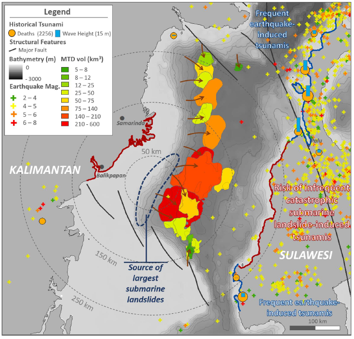
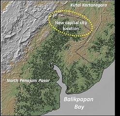
The announcement in 2019 about the transfer of the Indonesian capital from Jakarta to Borneo, in the province of East Kalimantan, set off alarms among the scientific community. The location had been identified as an area of potential tsunami risk.
In early 2019 a research team from Heriot-Watt University, led by Dr Uisdean Nicholson, started collecting data on ‘Ocean currents and submarine landslides: assessing tsunami risk in the Makassar Strait’. The project included partners from Bandung Institute of Technology in Indonesia, and the British Geological Survey. The collaboration is enriching the knowledge of Indonesian geological and geophysical communities on sedimentation and landslide hazards in the Makassar Strait in Indonesia.
The research team identified a potential tsunami risk in the region chosen by Indonesia for its new capital. Multiple ancient underwater landslides in the Makassar Strait were mapped between the islands of Borneo and Sulawesi during the first phase of the project. Indicating that, if the largest of these were to be repeated today, it would generate a tsunami capable of flooding Balikpapan Bay, an area close to the proposed capital.
The results were published in the Geological Society of London and by the BBC, awakening a lot of interest in different sectors in Indonesia.
Researchers from the Bandung Institute of Technology and other academic partners are now advising the Ministry of Energy in charge of planning this new capital. This discovery, far from being alarmist, is intended to lay the groundwork for decision-makers to reconsider their position to locate the new Indonesian capital in the East Kalimantan region.